
 AUS
AUS USA
USA GBR
GBR CAN
CAN NZL
NZLUsing the Explorer
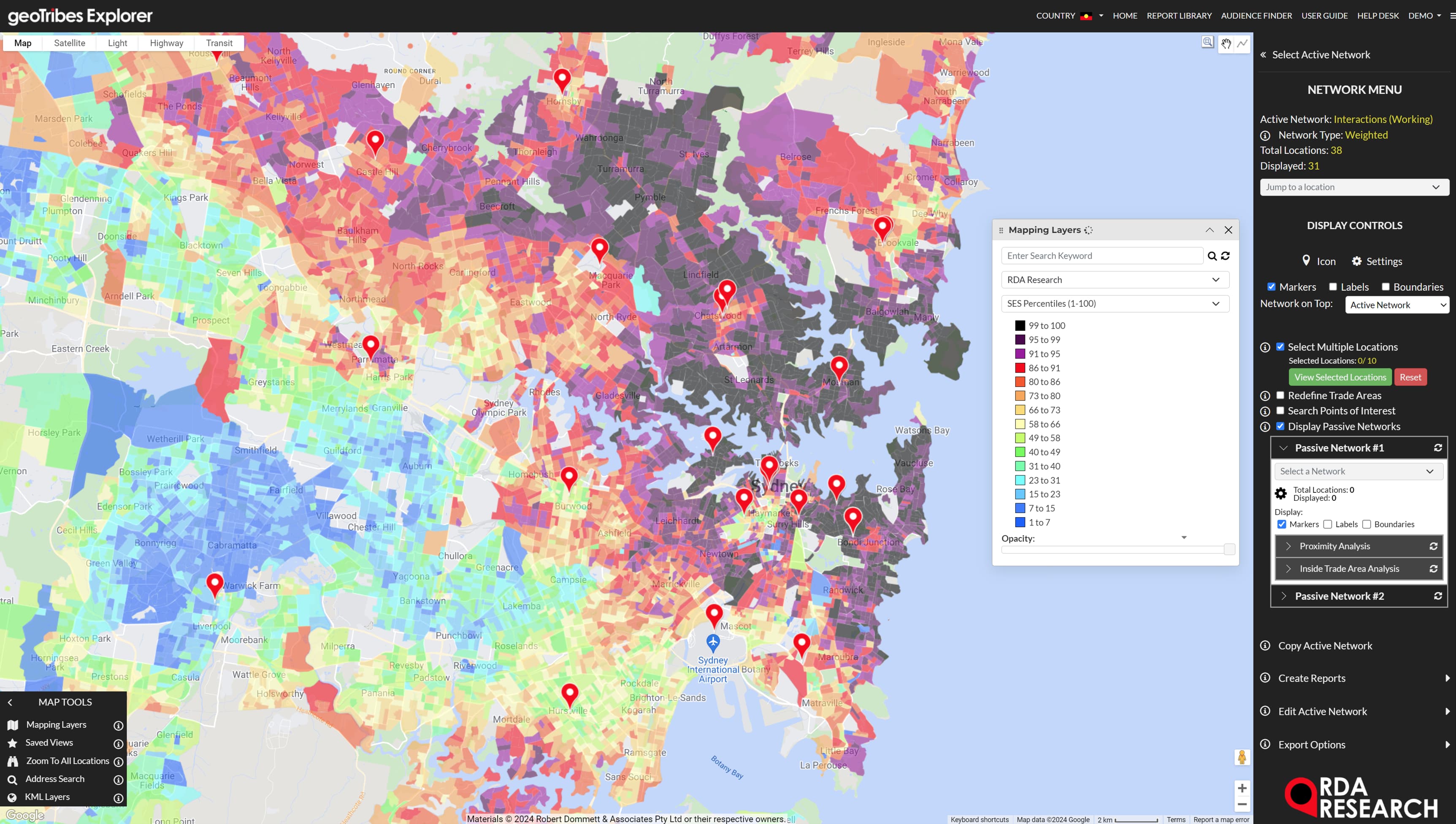
Discover, visualise and share insights about customers, locations, markets, audiences and media assets, guided by expert workflows.
With the Explorer you can:
- Create presentation quality maps
- Build deep profiles of regions and retail trade areas
- Identify retail network performance gaps
- Estimate new store sales
- Find whitespace opportunities
- Estimate store & network cannibalisation
- Run proximity & inside trade area analyses
- Quantify target market segments
- Test alternative network coverage scenarios
- Plan OOH media campaigns
The Explorer supports single users as well as collaboration among enterprise teams through a fully cloud-hosted application, developed in line with AWS Well-Architected Framework principles.
Why Smart Planners Choose the Explorer
Turn Your Behavioural Data Into Strategic Competitive Advantage
The RDA data science team has deep experience in turning spatially-referenced data, such as de-identified transactions, transport models and mobility data into customised, private data layers in the Explorer.
Customised layers include:
- Retail store trade area definitions based on actual shopper behaviour, transport models or mobility data
- Projected $/Household sales extraction rate at the level of fine-grained census geography
- Modelled potential demand estimates (Available and Obtainable Market), based on applying machine learning models to projected household sales
Use Powerful Geo-Analytics With Point-and-Click Ease
The Explorer goes beyond mapping and dashboarding with powerful embedded geo-analytic capabilities like:
- Drive time & custom trade areas
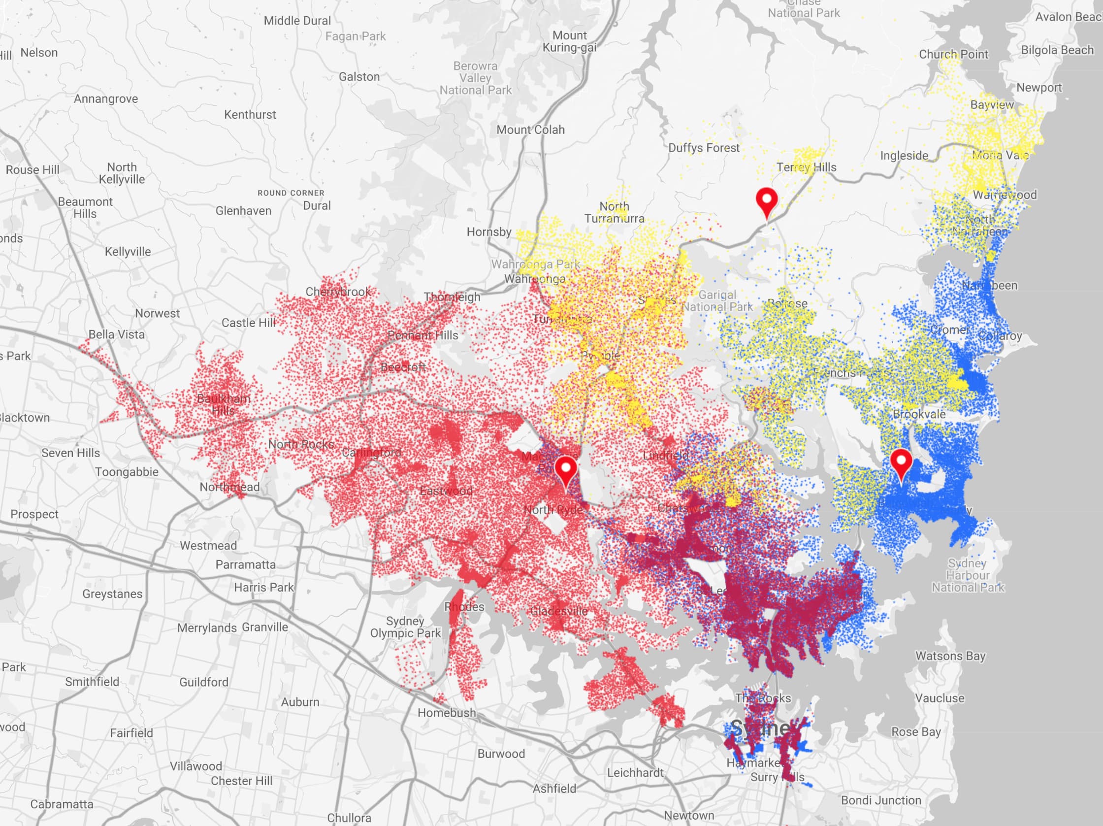
- Spatial interaction models
- Lookalike locations search
- Custom segment generation
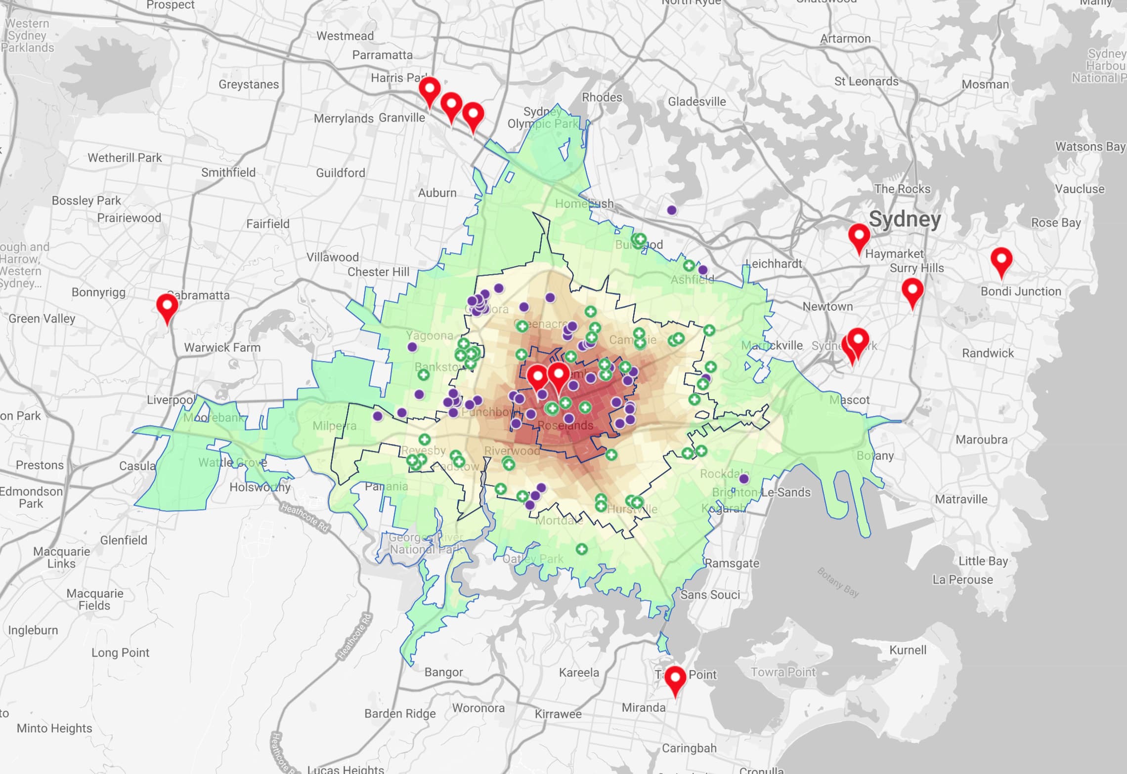
- Proximity and inside trade areas analyses
- Network footprint analysis
- Network cannibalisation analysis
- Real time Google POI search
Walk In The Footsteps of Planning Experts
The Explorer's intuitive interface supports corporate planning, retail network analytics and campaign targeting with expert workflows including:
- Market gap analysis
- Network opportunity ranking
- New store sales estimation
- Cannibalisation analysis
- Whitespace identification
- Served market profiling
- Franchise territory planning
- Outdoor media planning
- Target market sizing
- Local area marketing
- Competitive battleground analysis
Inexperienced users can plan like an expert, because our years of experience are built into the Explorer itself.


Really Get To Know Your Customers
Our geoTribes and geoSmart Segments are embedded in the Explorer, so your planning, analysis and targeting can be based on industry-standard and readily interpreted segments. These can also help you to better understand:
- How shoppers vary across different stores
- Which trade area segments are shopping at particular stores
- How to target local area marketing
- How to adapt store ranging to different trade areas
Bring Custom Audiences To Life
Explorer’s Audience Finder tool enables users to build bespoke consumer audiences using any combination of demographic, behavioural, household demand, economics, attitudinal & lifestyle measures from RDA and Nielsen’s GeoCMV data.
In a seamless workflow, users can:
- Design audiences
- Choose the right geographic level
- Analyse reach
- Adjust for proximity
- Map hotspots
- Produce target area lists

Customise Your Solution > Only Pay For What You Need!
Your Explorer Solution is highly configurable from a broad range of options, so you only pay for the users, data and analytical features you need, based on:
- Number of users
- ABS and public data, e.g. Population Projections & Business Register
- Census, media & other commonly used boundaries
- Public data sets, e.g. Natural Disasters, Transport Routes, Business Register & Land Use
- Human insights data modelled from market research and Government microdata, e.g. Health and Wellbeing, GeoCMV, Attitudes & Values, Sustainability Behaviour
- Client-supplied proprietary data, e.g. Transport models, Population Projections, NPS Scores
- Custom audience/target market generation, with the Audience Finder Tool
- Custom analytical layers built from transaction, loyalty and mobility data by the RDA data science team.
- Advanced geospatial analytics, e.g. Territory Management, Spatial Interaction Modelling & Finding Lookalikes
- Access to Google Points of Interest & Travel Time
Who Uses The geoTribes Explorer?
Individual analysts and enterprise teams who require advanced features with high ease-of-use.
- National retail chains, especially those with addressed loyalty transactions data
- Large and medium-sized outdoor media companies
- Management consultancies
- Media planning agencies
- Planning and analytics departments in the corporate, education and sporting sectors

Downloads
Message us
Discover how the geoTribes Explorer can extend your team’s market-intelligence capabilities, with minimal investment and lead time.